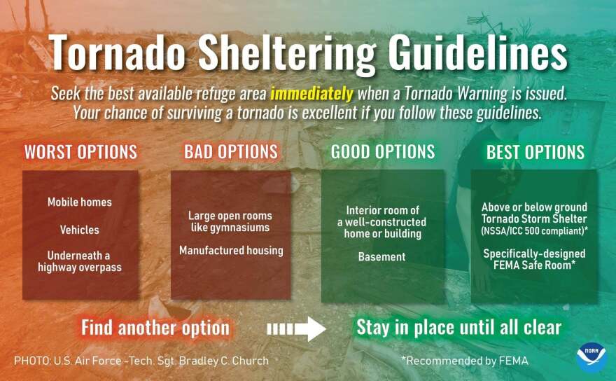
SEVERE WEATHER –A thunderstorm watch is in effect for the Red River Radio listening area as a line of strong to severe rainshowers is moving from the west to east across East Texas. By late morning, much of Southwest Arkansas, Northwest Louisiana, and Deep East Texas will begin to be affected. According to the National Weather Service-Shreveport: Areas for the greatest risk for severe weather will be over South Central Arkansas and North Central/Northeast Louisiana and along the Arkansas-Mississippi border Wednesday afternoon .
"Locations like Shreveport, Ruston, Nacthitoches, and up into southwestern Arkansas, Columbia, are all in an enhanced risk," explained Meteorologist Charlie Woodrum with the National Weather Service in Shreveport. "The biggest risk for severe weather is going

to be Wednesday afternoon for the ArkLaMiss for El Dorado (Arkansas) and Monroe (Louisiana)."
National Weather Service radar indicated a long band of heavy rain between Tyler and over Longview Texas—Stretching as far southwest as Brenham and to the northeast of DeQueen, Arkansas.


